News
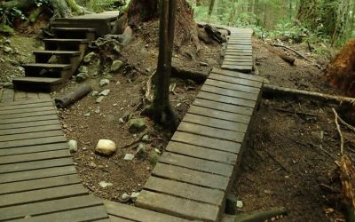
Spring 2015 Trail Updates
2015 is in like a lion! Lots happening on the slopes to improve our trails and create connectivity in our network.
Here is the latest…
Fiver #1 – Presented by North Shore Bike Shop
It's time. Time for the first Fiver of 2015. We are kicking off the season with long time Toonie sponsor and supporter North Shore Bike Shop.
As you can see from the map we're on Seymour and staging will be taking place at Parkgate Park. We have used this location twice in 2014 and it's proven to be a great spot. There is limited parking in the area, please carpool if you can, ride from home, or park dispersed around the neighbourhood.
Sign in will run from 5:45pm to 6:45pm. There is no fixed start time, you can start out onto the course once you have signed in.
Remember you MUST be a current paid NSMBA member to participate.
Get your 2015 Membership HERE
You can pre-pay and register for the whole 2015 Fiver Series HERE
NSMBA Fiver # 1 Presented by North Shore Bike Shop on Trailforks.com
2015 Season Opener!
Time to kick off this season with a bender!
It’s happening at the Raven April 9th! What’s happening? Our yearly season opener party! For a $15 set back, you gain: entry to a wicked time with your bike buddies in a great pub, beers that help pay directly for the trails, pizza!, (did we mention pizza?), rad door prizes and live music!
And now for the following. This is not just a fun party to hang out with your friends and make new riding plans, this is also a fundraiser. And the stakes are high folks! Buy yourself raffle tickets for the following prizes…
Grand prize is a Rocky Mountain Altitude 750 MSL Rally Edition! (size: Medium)
This is not just any bike people. Can you imagine yourself rocking the NSMBA Toonies on this steed?
Renew Your Membership Today!
It’s that time of year again to renew your NSMBA membership.
Not only does your membership contribute to maintaining and building the world-class trail network on Fromme and Seymour, but it also gets you access to our race series, early access to the NSMBA Gear Swap, access to our wicked social events and more! With your membership you are helping to build a stronger voice for mountain bikers and trails users on the Shore.
2014 memberships expire February 28th, 2015 so renew today!
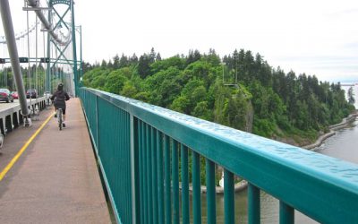
Lions Gate Bridge North Approach Viaduct Rehabilitation Project
Cyclist and Pedestrian Alert
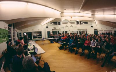
AGM Recap 2014
2014 AGM Recap
TAP 2015 Open for Adoptions
Seymour River Rockslide Updates
SEYMOUR RIVER CANYON TRAIL CONNECTION UPDATE
What Happened?
In December 2014, a rockslide occurred in Seymour River Canyon, approximately one kilometre north of Riverside Drive, in the Lower Seymour Conservation Reserve (LSCR). The rockslide, which partially blocked Seymour River, is made up of an estimated 50,000 cubic metres of rock – that’s enough rock to fill a 13-story apartment building. As a result of the blockage the water level upstream increased, flooding area trails and the historic Twin Bridge. For safety purposes, both part of Fisherman’s Trail (from Mystery Creek to the Twin Bridge) and Bottletop Trail were closed and the Twin Bridge was removed.
Where are we Now?
To ensure the network of trails offered in Seymour River Canyon continue to be safe and accessible for recreational users from around the region, Metro Vancouver is in the early stages of gathering input on:
∙ a new pedestrian bridge across Seymour River
∙ new trail connections
∙ operational access to east side of Seymour River
Metro Vancouver recognizes the importance of the impacted trails and is committed to working closely with the community to address concerns, discuss options and identify new opportunities for the LSCR trail network in Seymour River Canyon.
What’s Next?
Metro Vancouver wants to hear from you. In June 2015, Metro Vancouver is hosting a public meeting to discuss progress, gather input, listen to feedback and answer questions. Please join us:
Date: Wednesday, June 24, 2015
Time: 6:30 – 9:00 pm
Location: North Shore Ballroom
Holiday Inn & Suites North Vancouver
700 Old Lillooet Road, North Vancouver, BC
RSVP: If you are interested in attending, please visit www.trailconnections.eventbrite.ca to register or call Metro Vancouver’s Information Centre at 604-432-6200.
For More Information
Visit: the Lower Seymour Conservation Reserve web page
Call: Your Community Liaison Officer at 604-436-6986
Email: icentre@metrovancouver.org with the subject line “Seymour River Canyon” to sign up for e-updates.

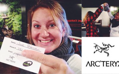
Arc’teryx Provincial Builders Academy Prize Winner!
Congratulations to Jase Petersen from Kamloops who attended our Provincial Trail Builders Academy.
He has won an Alpha SV Jacket donated by Arc'teryx. Please contact christine@nsmba.ca to coordinate sizing and details. Congrats!
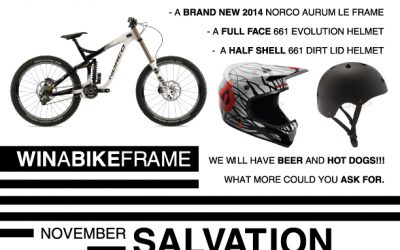
Nov 9 Trail Day on Salvation sponsored by Norco John Henry Bikes

District of North Vancouver Municipal Elections – November 15th
General voting day is Saturday, November 15, 2014 from 8am to 8pm
Get out and vote before you ride!
To find out more about voting locations visit: http://www.dnv.org/notfound
Get to know your candidates visit: http://www.dnv.org/notfound
All Candidate North Van Sports Council Q & A
2015 Builder Academies
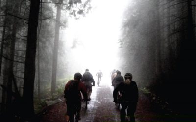
North Shore Triple Crown October 11th
Meet – Old Buck Parking Lot Seymour
Starting Point – Old Buck Parking Lot – SEYMOUR
Up Old Buck to 1st switchback, road to TNT, Dales, Foreverafter, Highschool back to bridal path, left to Hyannis – down to river and up twin bridges (options on Bottletop)
Climb up Twin Bridges access the new trail south of the Plant and cross onto Bike path west of road avoiding Gazebo to Rice Lake Rd –
Twin Bridges to Rice Lake Rd, End of the Line Cafe (first re-group spot).
FROMME
From ‘End of the Line’ Store on Dempsey turning North up Underwood to West on Coleman then onto Hoskins connecting with McNair and onto Mountain Hwy to the water tower (option on climbing McNair via Griffin)
Up the gravel of Mountain Hwy to Executioner Trail, descending to Dream Weaver then heading west on Baden Powell to Mosquito Creek and continuing Down Skyline to Mount Royal Drive or to Grouse Parking Lot, then Cleveland Dam. (second meeting spot – food can be grabbed at the Store on Mount Royal, just off of Capilano Rd – thus the descent down Skyline Road)
Re-Group POINT 2 – will be located at Cleveland Dam.
Entering West Vancouver at Cleveland Dam finishing at Horseshoe Bay
WEST VANCOUVER ROUTE DESCRIPTION
CYPRESS
Climbing from Cleveland Dam, stay right on gravel and curve around to the metal fence, stay along the fence until you reach pavement. Turn right through BP’s onto Glenmore dr, left on Morven Dr past school, left on Glangarry Cres back to Glenmore dr heading south on Bonnymuir, this intersects with Southborough Dr/ Stevens Dr. Turn right then right onto Kenwood Rd, right on Elveden Row to a right on Eyremount Dr to the corner of Millstream Rd – here you will see a trail head – take the Millstream Connector Trail heading across to First switch Back on Cypress Bowl rd. Up Cypress Bowl road to the second switchback.
Take the gravel road through the gate, about 2-300 meters up drop into Slippery Canoe this comes out on a gravel road, just across the road is another trail with a slight uphill, take this to the next road crossing, directly across and just to the right is Tall Cans – drop down to the next road, a little to the left 40 feet the trail continues – when you reach the next road turn right and take that out to the powerstation, once past the power station on pavement turn right, cross bridge over CYPRESS Falls and turn left – take this road for a couple of km’s, just before the trans Canada trail there is Nelson Creek to the old highway, turn right on old highway, on the left will be some stairs, they will take you down to an old reclaimed rail trail, from here you will progress to Eagle Heights above Horseshoe Bay, continue straight into Horseshoe bay for the celebration.
Results – Toonie #4 Presented by Lynn Valley Bikes
Toonie #4 Presented by Lynn Valley Bikes Results 2014-06-12 Men Overall Place Name Stage 1 Rank Stage 2 Rank Stage 3 Rank Total Time 1. Jamie Biluk 0:05:25 2. 0:09:57 1. 0:11:58 1. 0:11:58 2. Andreas Hestler 0:05:23 1. 0:10:02 2. 0:12:11 2. 0:12:11 3. Luke Penner...
Fromme Parking Lot
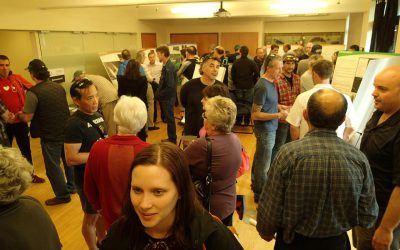
The Open House in May was well attended. Was your voice heard?
A public open house was held this month to outline and solicit input from the community regarding the Fromme parking lot as proposed by the District of North Vancouver.
It was well attended by local residents and to no surprise, continues to be a polarizing topic.
It has been a long standing issue that was the catalyst for the Fromme Mountain Sustainable Trail Use and Classification Plan.
Subscribe to the NSMBA Newsletter
Looking for NSMBA news delivered to your inbox? Subscribe to our newsletter!
Email Address *
* indicates required